
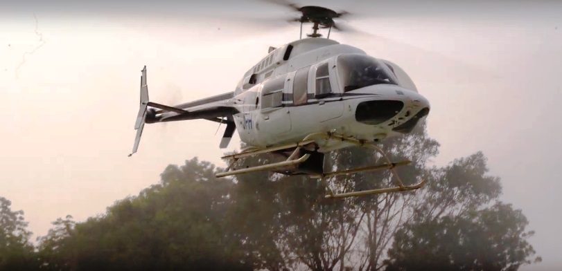
The work for High Speed Rail Network between Delhi-Varanasi has been started with the beginning of aerial ground survey through a helicopter fitted with imagery sensors and Aerial Light Detection and Ranging Survey (LiDAR). Through the first flight of this helicopter, the imagery sensors captured the related data to the ground survey.
It is through LiDAR technology adopted by the National High Speed Rail Corporation Limited (NHSRCL) all the ground details and data are provided in just 3-4 months which otherwise takes 10-12 months normally.
For any linear infrastructure project, ground survey is a crucial activity. It is through using a combination of Laser & GPS data, actual photographs and flight parameters, LiDAR technique gives accurate survey data.
NHSRCL has been given the work to prepare detailed project reports for seven High Speed Rail Corridors and for ground survey in all these corridors, LIDAR survey technique will be used. Already for Delhi Varanasi High Speed Rail Corridor, the detailed project report has been submitted to the Railway Ministry.
As per the proposed plan the DVHSR corridor will connect the National Capital Territory with the major cities like Agra, Mathura, Lucknow, Etawah, Prayagraj, Raebareli, Bhadohi and Ayodhya. The 800 km(approx) long Delhi to Varanasi corridor will be connected to Ayodhya as well. The High Speed Rail (HSR) route will also be connecting the international airport coming up at Jewar.